Powering Australia’s renewable future: coordinating delivery of Snowy 2.0
Project overview
Established in 1970, SMEC (Snowy Mountains Engineering Corporation) has its roots in the world-renowned Snowy Mountains Hydroelectric Scheme, one of the great civil engineering achievements of the 20th century. Today, SMEC is playing a central role in delivering Snowy 2.0, the largest committed renewable energy project in Australia, set to provide on-demand clean power and large-scale storage to the National Electricity Market.
Leading the delivery of a mega infrastructure project
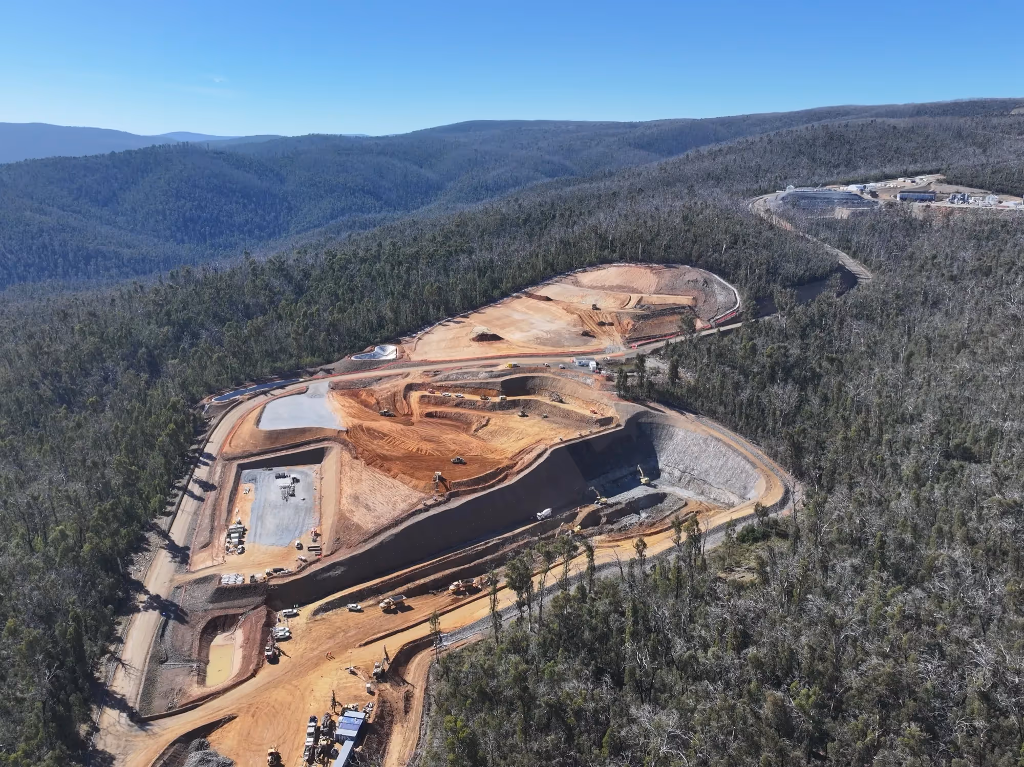
Snowy 2.0, the pumped hydro expansion of the iconic Snowy Hydroelectric Scheme, is one of the most complex and challenging feats of engineering underway anywhere in the world. Essentially a giant renewable energy battery, Snowy 2.0 will store excess power generated from wind and solar and release it back into the grid when it’s needed most.
With a capacity of 2,200 MW, Snowy 2.0 will deliver enough energy to power 3 million homes for a week - the equivalent of around 23 million home batteries. The scale and capability of the project are remarkable.
Built with a design life of 150 years, Snowy 2.0 will play a vital role in underpinning Australia’s clean energy future for generations to come. When complete at the end of 2028, it will become the centrepiece of Snowy Hydro’s unmatched mix of on-demand power stations, keeping the lights on as more clean wind and solar enter the grid. Since 2017, SMEC has served as part of the Owner’s Team, providing technical expertise in hydropower, tunnelling, and geotechnical engineering to ensure safe, efficient, and innovative delivery.
Using Revizto as a data bridge
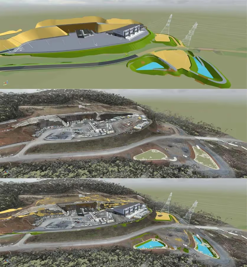
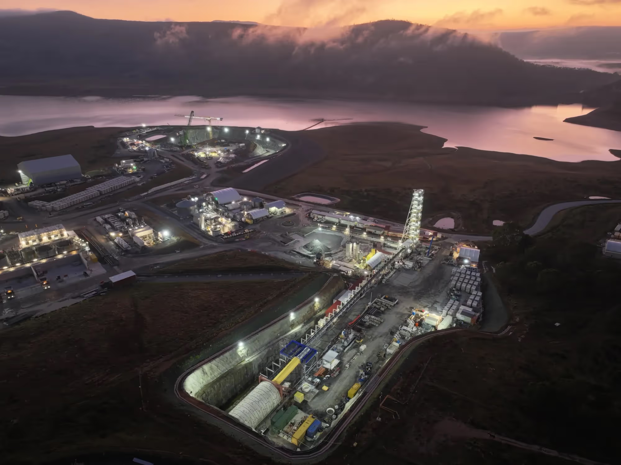
On a project as big as Snowy 2.0, with tunnels stretching through rugged mountain terrain and a power station located 800 meters underground, real-time coordination is critical. Using Revizto, the project team could quickly access 3D spatial data within 24 hours and overlay point cloud data with design models, giving everyone a clear, 360-degree view of the site.
To date, the team have produced around 400 design models, 2,500 LiDAR scans, and 27 kilometers of geological models. This wealth of digital information fed directly into the platform, enabling engineers and project managers to assess progress, track installed support, and share updates instantly. At the same time, stakeholders across multiple offices could align through a single source of truth. This digital environment makes collaboration easier, connecting hundreds of team members across disciplines—no matter their location or skill set.
Revizto’s ability to seamlessly host an outrageous amount of data and models continues to blow me away. It has streamlined collaboration across the whole project, providing a single source of truth for hundreds of team members based in different locations around the world.
Kevin Golding
Digital Engineering Coordinator
Digital geological engineering in mountainous terrain
Traditional photo face maps make it difficult to accurately locate rock features and communicate them back to the office-based geo-modelling team. Using Revizto, the site team were able to overlay scan data directly with design models and flag features of interest through the Issue Tracker. This created a clear workflow for office-based geo-modellers to model and project these features efficiently, ensuring critical geological information is shared in real time.
Using Revizto, we can easily provide access for the team to the projected surfaces onto tunnels that haven’t yet been excavated. This increases safety and quality while reducing the risk of geological overruns.
Kevin Golding
Digital Engineering Coordinator
Challenges
- Hundreds of users across global teams with seven distinct coordinate systems.
- Massive data volumes across multiple formats.
- Complex alpine geology and geotechnical uncertainty.
- Traditional photogrammetry is hard to map accurately.
Solutions
- Single collaborative platform, ensuring consistency across all teams and data sources.
- Direct import of .laz files and rapid access to photogrammetry for real-time decision-making.
- Visual context for geotechnical analysis and risk sharing.
Predicting challenging tunnel conditions
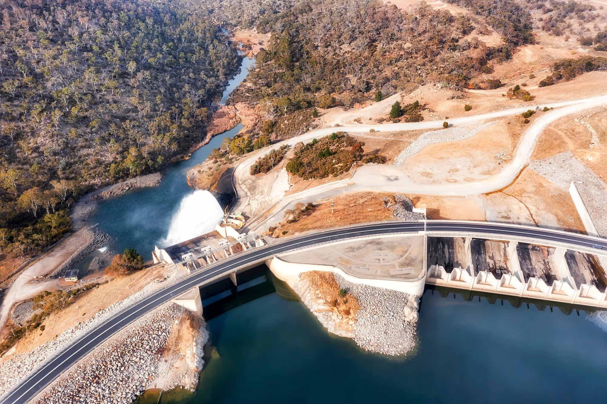
Snowy 2.0 involves linking two existing dams, Tantangara and Talbingo, through 27km of tunnels. To do so successfully, the team had to leverage integration of LiDAR and photogrammetry scans with design models, alongside direct .laz file imports, to provide detailed, near real-time views of tunnel conditions. Revizto helped bring all of these formats together in one platform, allowing the team to quickly assess excavation progress and visualize geological features across multiple tunnels.
How Revizto enabled Snowy 2.0’s success
- Best-In-Class Security & Data Sovereignty
Allowed access to models and scans for 750+ team members across owners, contractors, and designers. - Unified 2D/3D Environment
Combining rock face scans with design data to support the balanced Geotechnical Baseline Report model. Seamlessly overlaying LiDAR and photogrammetry scans with design models, including direct .laz file import. - Integrated Task Management
Simplifying communication between site teams and office-based geo-modellers, reducing delays and errors.