2D Overlay
Powerful visualization for non-technical stakeholders
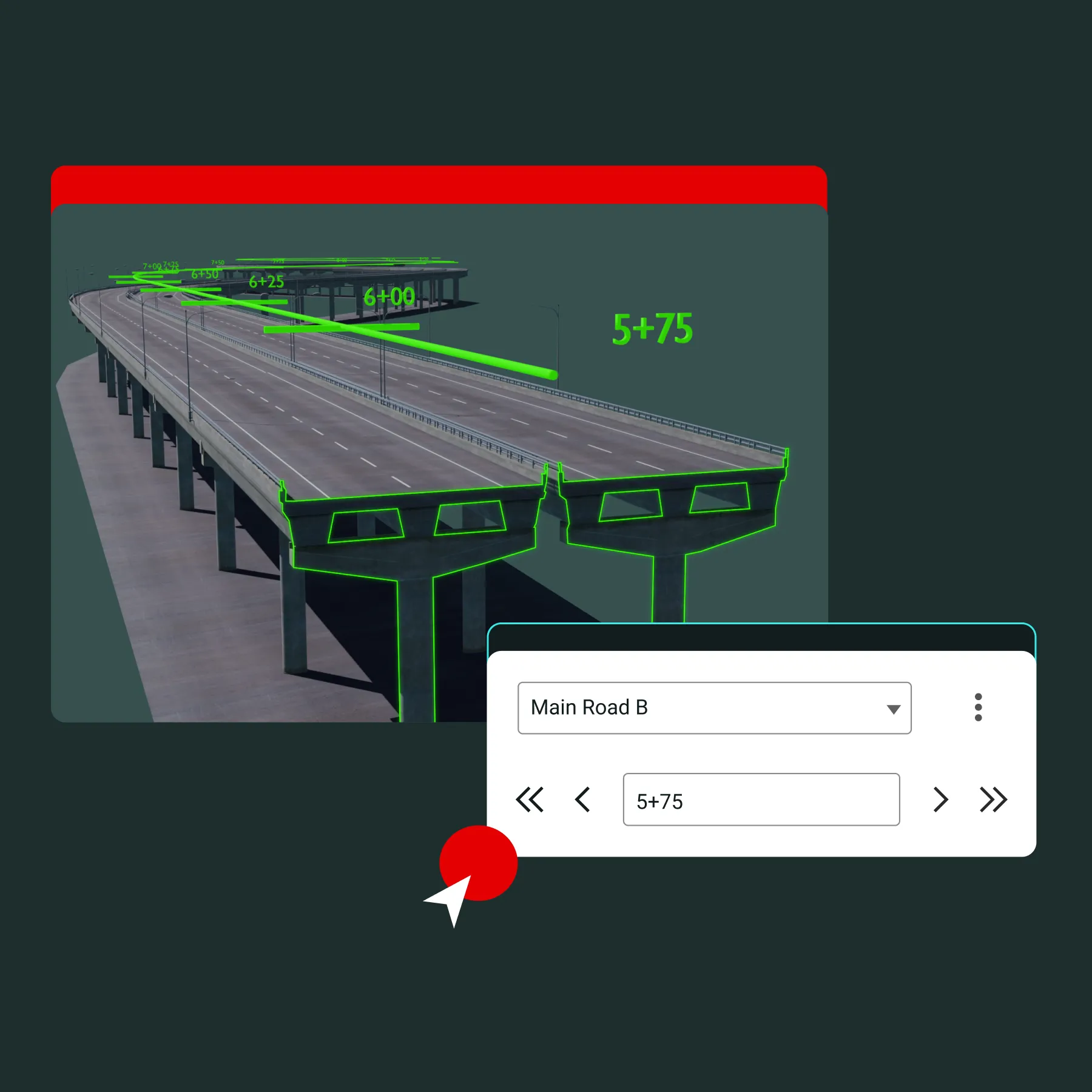
Overlay 2D drawings and point clouds directly onto 3D models to help all stakeholders understand what they’re looking at.
- Spot inconsistencies
- Validate data
- Improve coordination
The only platform that seamlessly unites all 2D drawings and 3D models in one environment for full project context and effortless collaboration.
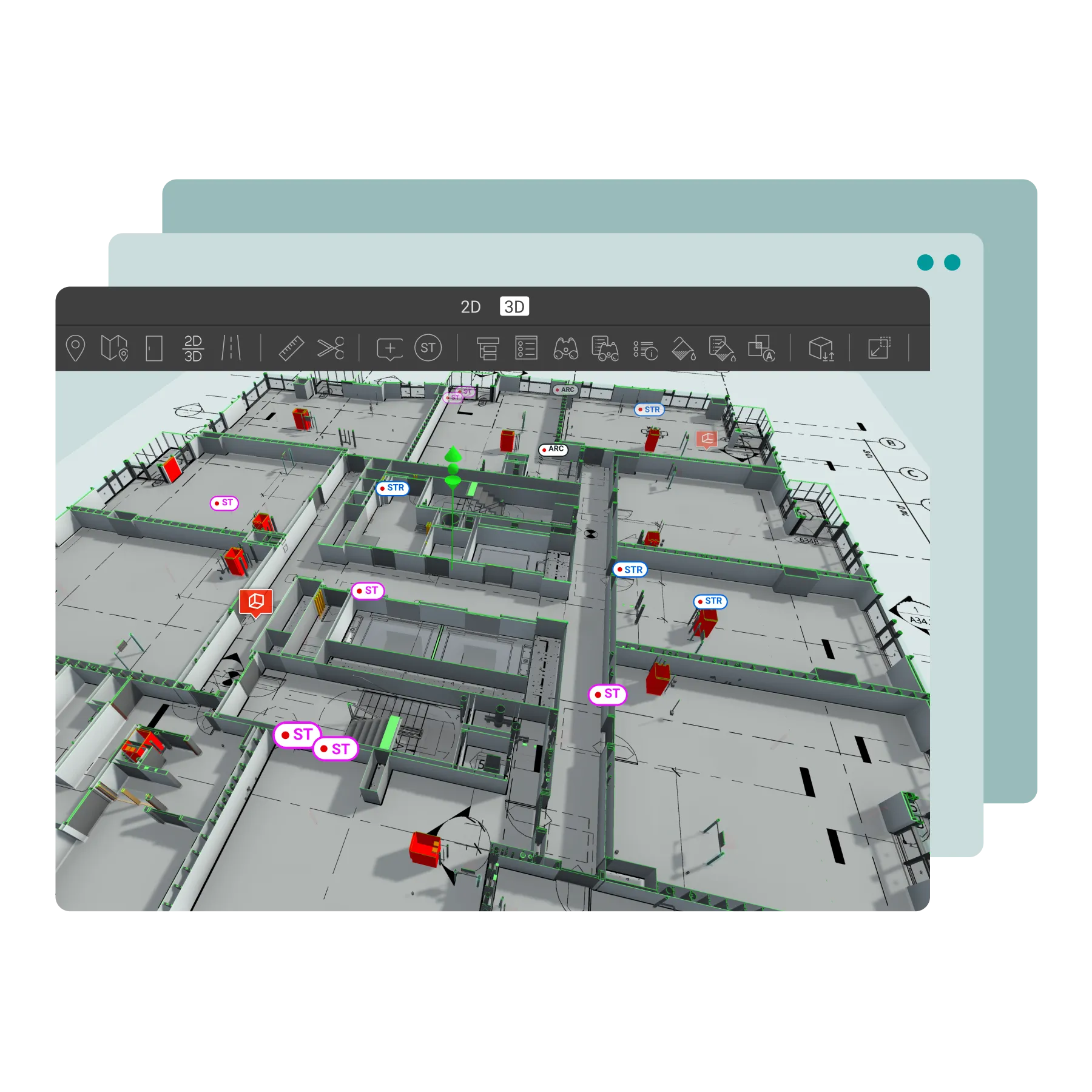
Overlay 2D drawings and point clouds directly onto 3D models to help all stakeholders understand what they’re looking at.
Simultaneously view 2D drawings and 3D models for smarter decision-making. View 2D drawings and 3D models side-by-side.
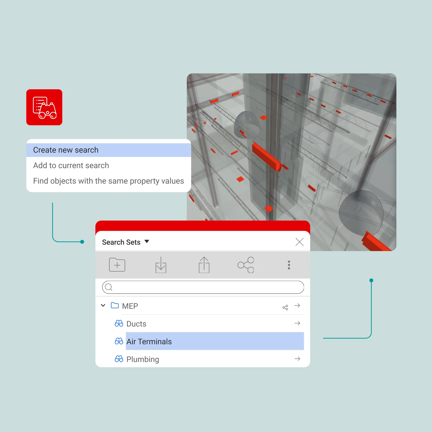
Find what you need fast with simple keyword searches and custom search sets.
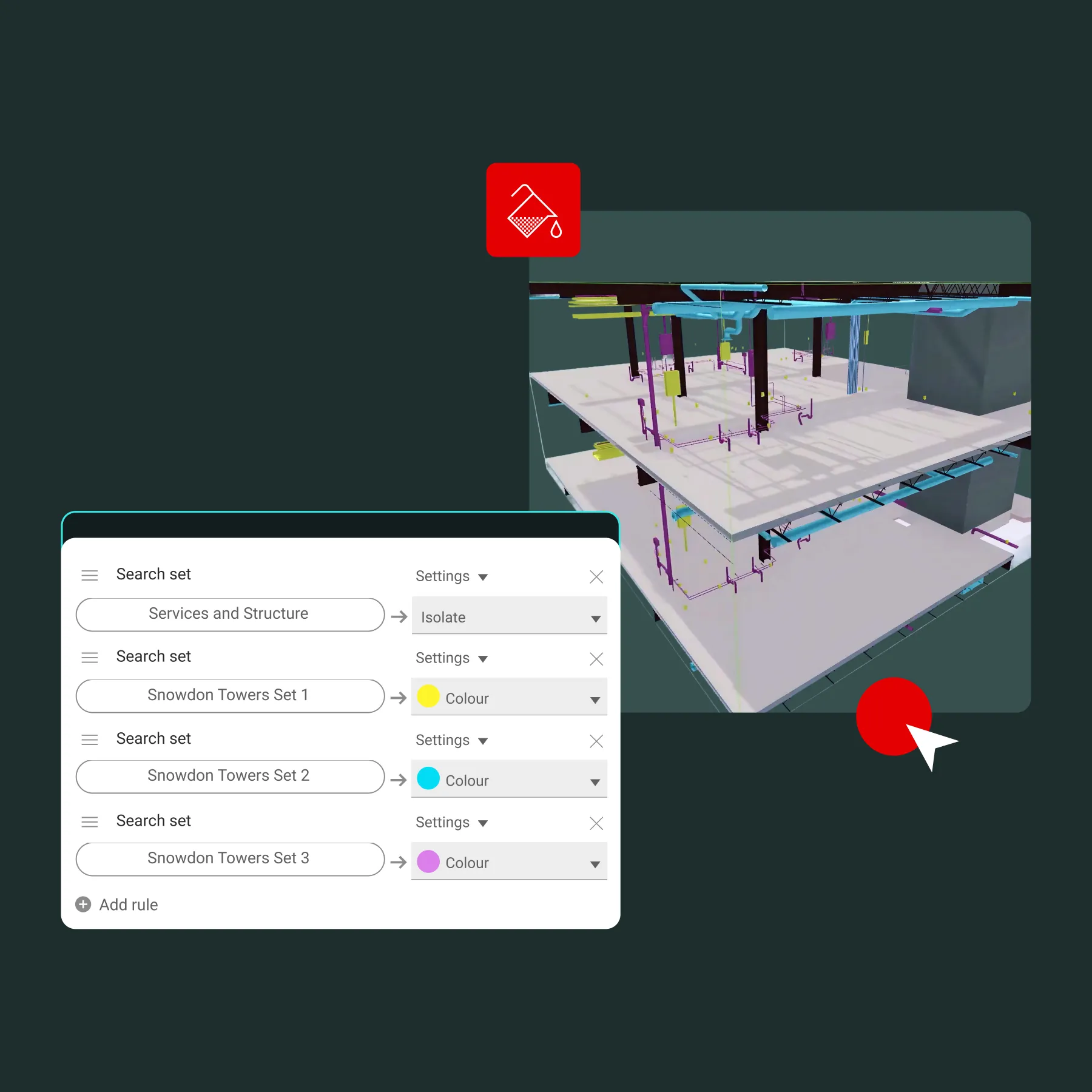
Easily isolate, color-code, or hide model elements for visual clarity.
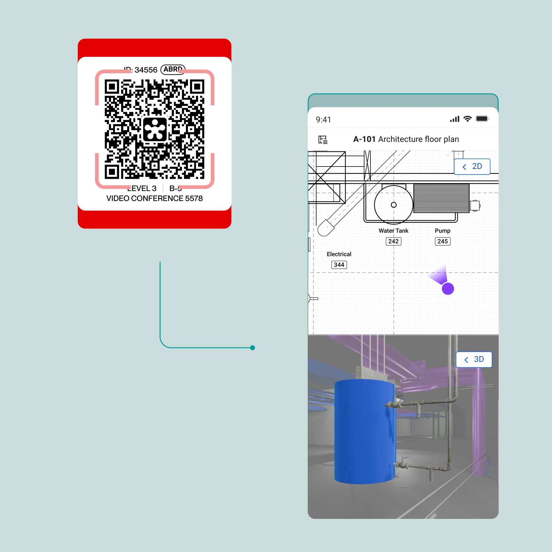
Close the gap between 2D plans and the field. Enhance safety, track issues, and validate design.
Accelerate the design, delivery, and maintenance of infrastructure projects with precision coordination.


“Having all the information located together in one platform – the 2D drawings, 3D model, all the issues, in one platform that's easily accessible – that's been a huge benefit and it's saved a huge amount of time."

The unified platform enables automated issue identification, grouping, and direct conversion to assigned issues within the same platform. Teams can run clash tests, immediately group results by customizable parameters, filter for specific stakeholders, and sync directly to the issue tracker with automated routing, significantly cutting coordination time compared to traditional multi-tool workflows.
Yes. Many of Revizto’s core customers are general contractors using it as their centralized coordination platform. The unified environment federates all BIM data, 2D drawings, and issue tracking into one accessible location, eliminating fragmented communication and ensuring all stakeholders work from current information regardless of technical expertise.
Revizto delivers a single platform combining 3D/2D viewing, issue tracking, and real-time collaboration without switching tools. Traditional tools like Navisworks require separate applications for workflow management, while Revizto integrates automated issue identification, grouping, and issue resolution in a single environment to reduce syncing time and information handling.
Revizto uses reference point alignment where users select matching control points on both 2D sheets and 3D models to establish spatial coordination. Sheets exported directly from Revit maintain automatic alignment, while imported PDFs require manual calibration using visual controls and view range configuration to ensure that issues display correctly across both environments.