The future of infrastructure coordination is already here. This is how Revizto is doing it
Are you prepared for what’s next in AECO?
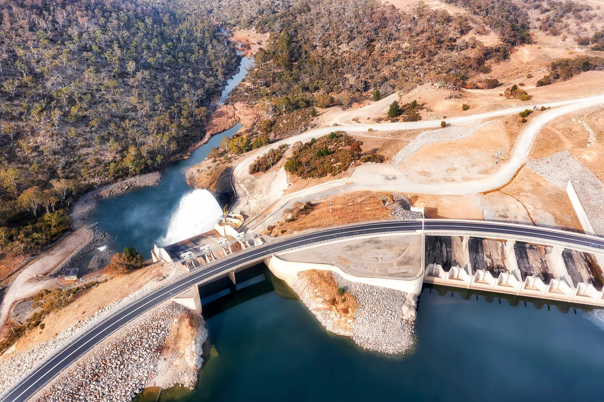
Infrastructure delivery is entering a new phase.
Rail corridors are growing in scale. Civil programmes are becoming more data-intensive. Asset owners expect lifecycle transparency. Governments demand stronger reporting and accountability.
The future of BIM for infrastructure projects is not simply about viewing larger models. It is about managing complexity at corridor scale — with clarity, governance and integrated data.
Revizto is evolving to meet that future.
Infrastructure coordination is shifting from vertical logic to corridor logic
For decades, digital workflows were shaped by building construction. Coordination revolved around levels and grids.
Infrastructure operates differently.
As Elyse Whissell Bergeron, Industry Consultant at Revizto, emphasized in the 5.17 webinar:
“For infrastructure projects, linear alignments play the same role that levels and grids do in buildings—they define how teams navigate and coordinate the project.”
Rail, road and civil projects are organised around alignments, not floors. They extend across geography, disciplines and phases. Traditional building-centric coordination tools often required workarounds to simulate corridor logic.
That is changing.
Revizto now supports native alignment-based navigation — eliminating the need for manual zone creation and improving how teams coordinate across multi-kilometre infrastructure environments.
Alignment-aware navigation: the foundation of future infrastructure workflows
Alignment-based coordination enables teams to:
- Navigate by chainage
- View position relative to corridor alignment
- Section vertically or perpendicular to profile
- Drag sections along rail or road corridors
- Snap measurement tools directly to alignment-based sections
Previously, infrastructure teams had to improvise these workflows.
“A lot of our clients were using Revizto for infrastructure before we had a specialized tool… they did have to go through certain workarounds.”
Elyse Whissell Bergeron
Industry Consultant at Revizto
With alignment-native workflows, infrastructure construction software now reflects the physical logic of rail and civil delivery.
Corridor-based issue tracking for distributed programmes
Infrastructure projects generate thousands of coordination issues across distributed geographies.
Revizto now ties issues directly to alignment position, enabling filtering by chainage.
“You pick from where to where and it will filter all the issues that you have in this distance of your project based on alignment position.”
Elyse Whissell Bergeron
Industry Consultant at Revizto
For BIM for infrastructure projects, this represents a shift from generic issue tracking to corridor-based governance.
Teams can isolate specific segments of a rail or road programme while maintaining full visibility across the broader alignment.
As infrastructure projects increase in size, this structured issue filtering becomes essential to maintaining accountability.
Integrated BIM and GIS: the next standard in infrastructure construction software
Infrastructure coordination extends beyond 3D geometry.
It requires integration of:
- BIM models
- GIS datasets
- Survey information
- Point clouds
- Drone capture
- Underground utility data
Disconnected environments increase risk and limit visibility.
A future-ready civil infrastructure collaboration platform must unify these data types into a single federated environment.
Revizto continues to strengthen this integration — enabling infrastructure teams to review assets in geographic context, not just model space.
For rail and highway programmes especially, BIM and GIS integration is foundational to digital maturity.
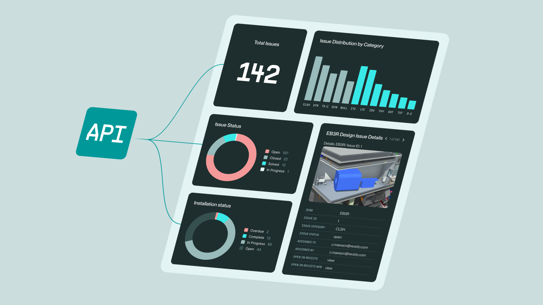
“You do not need to publish every issue in the issue tracker anymore”
The future of infrastructure construction software goes beyond detecting clashes.
It requires structured reporting and executive-level visibility.
Revizto now supports grouping clashes by search set, enabling more precise organisation of coordination conflicts. Clash charts provide visibility without requiring every clash to be converted into a formal issue.
“You do not need to publish every issue in the issue tracker anymore to have proper reporting on your clashes.”
Elyse Whissell Bergeron
Industry Consultant at Revizto
This represents a broader shift — from reactive clash management to coordination intelligence.
With API access and Power BI integration, infrastructure organisations can connect clash data directly to programme dashboards and reporting frameworks.
For publicly funded infrastructure projects, that level of transparency is increasingly expected.
.avif)
Supporting iterative and option-driven infrastructure design
Infrastructure delivery is becoming more iterative and data-driven.
Local preview functionality allows users — particularly in Revit workflows — to temporarily publish and validate design options without disrupting the shared model environment.
“Sometimes you don't want to update all of your models to see if what you've coordinated actually is solved.”
Elyse Whissell Bergeron
Industry Consultant at Revizto
This controlled experimentation reduces risk and supports smarter decision-making before formal publication.
As infrastructure complexity increases, safe iteration becomes a critical component of digital coordination.
Data validation and lifecycle accountability
Infrastructure assets are long-term public investments.
Data completeness and metadata accuracy are becoming as important as geometry.
Revizto now allows publishing of empty object properties, supporting validation workflows and quality control.
For asset owners and public authorities, lifecycle traceability will define the next phase of digital infrastructure delivery.
Infrastructure coordination is no longer only about building correctly — it is about documenting and validating data for decades of operation.