What digital tools can help manage increasing complexity in large-scale infrastructure projects?
Construction of large infrastructure projects is highly challenging and complex. Expansive projects related to transportation, utilities, water resources, communications, and other facilities require a wide range of participants and workflows in different areas of design, construction, maintenance, and operations.
While the definition of a large-scale infrastructure project varies, “megaprojects” typically have values exceeding $1 billion (US), according to the Project Management Institute. For these and other projects of all sizes, construction is becoming increasingly complex, as teams must address ever-evolving issues related to environmental, regulatory, safety, and other project requirements. The competitive nature of construction also requires working with tight schedules, challenging budgets, a limited labor pool, and project-specific challenges that can lead to ongoing scope changes.
Digital Tools for Managing Complexity
To address these challenges, an expanding array of digital tools and construction technology can help manage the complexity of infrastructure projects. Tools such as building information modeling (BIM), automation, virtual reality (VR), and artificial intelligence (AI) can help teams handle data from multiple sources and address numerous technical and logistical challenges.
BIM
BIM has established a vital role in infrastructure projects. The detailed 3D models and accompanying data provide digital representations of assets across their lifecycles, from conceptual design through construction and extending into operations and maintenance (O&M). This helps architecture, engineering, and construction (AEC) teams more efficiently collaborate on projects, working on one federated model instead of disparate files scattered across participants’ computers. The National Institute of Building Sciences (NIBS) has developed guidelines for standardizing BIM adoption and processes.
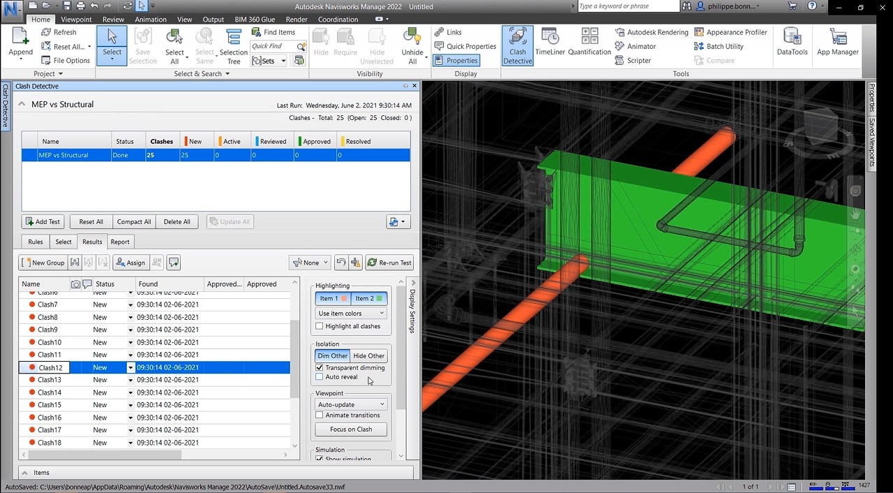
Through collaboration using BIM models, teams can improve productivity and quality, as well as better coordinate scheduling of project workflows. Interdisciplinary design teams can collaborate on design, perform design reviews, and track issues from a centralized platform. Clash detection tools can identify conflicts before they occur. For example, structural designs can be coordinated with mechanical, electrical, and plumbing systems to identify potential conflicts between structural elements and pipework.
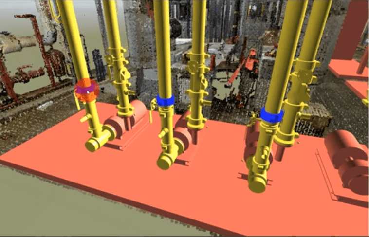
With a unified model, teams can virtually build and view projects within a single platform, coordinate activities, monitor progress, and manage changes throughout project lifecycles. BIM can also help teams communicate more clearly during meetings, providing a visual model and related data to discuss from different perspectives.
After construction, BIM continues to provide value. With the wealth of infrastructure data in BIM models, facility owners and managers can leverage models to guide operations and maintenance activities.
As part of the BIM process, many infrastructure projects employ digital twins — detailed digital replicas of physical assets — to manage projects across lifecycles. In addition to geometric data, digital twins might contain specifications, imagery, facility records, and other data related to project components, helping owners plan operations and maintenance activities. Sensors and Internet of Things (IoT) technology can provide data to help owners monitor performance of equipment in real time.
GIS
Along with BIM, geographic information systems (GIS) data provides large-scale planning and operational information for infrastructure projects. While BIM primarily focuses on individual projects or facilities, GIS typically operates on a city, county, or regional level, etc. The addition of geospatial information allows BIM data to be viewed in context with their surroundings and infrastructure.
Integration of GIS and BIM data enables reuse of valuable data and reduces data redundancy. Organizations can make more accurate and data-driven decisions about the environmental impact and sustainability of projects. This can aid a wide range of infrastructure planning and design efforts, such as environmental, transportation, and emergency management. The U.S. Department of Transportation provides additional information on using GIS for infrastructure projects.
AI
Artificial intelligence (AI) is another technology that is transforming the AEC industry, helping teams improve planning, scheduling, design, and overall efficiency and quality on infrastructure projects. AI-driven processes can help teams analyze large data sets and identify patterns and areas of improvement.
In project planning phases, AI can help identify potential schedule, budget, labor, and material issues based on similar projects and other pertinent data. In design, AI can help iterate through multiple design alternatives and make refinements, such as suggesting more sustainable designs or optimal positioning for mechanical equipment. AI-aided processes can reduce errors and rework, improve the accuracy of simulations, and offer predictions for future facility behavior, enhancing decision-making processes.
AI is also helpful during and after construction, by aiding contract analysis, resource planning, safety monitoring, and management of sensor information. By sifting through massive amounts of data, AI tools can notify managers of work-site issues and operational irregularities, guiding construction and O&M decision making.
Automation
Automation, which can work in concert with AI or separately, also contributes to improving efficiency, productivity, and quality. By automating repetitive tasks, such as routine computer-aided design (CAD) or tedious numerical analysis, teams can achieve huge time savings, freeing project staff to do more critical thinking or creative tasks.
Virtual Reality and More
Virtual Reality (VR), augmented reality (AR), and extended reality (XR) also provide valuable tools for infrastructure projects. These technologies transform BIM data into interactive, immersive experiences that help teams improve communication and make better-informed decisions. Other technology such IoT sensors, mobile devices, and drone technology also equip AEC professionals to tackle challenges of infrastructure projects.

Streamlining Collaboration using Digital Tools
Along with the various tools used for planning, design, construction, and O&M, a common data environment (CDE) and an integrated collaboration platform are also critical to the success of large infrastructure projects. A CDE is used to store, share, transfer, and modify project-related information throughout project lifecycles. A collaboration platform enables all team members to access, explore, communicate, and contribute to the project, regardless of their technical background.
Common Data Environment
With multiple project participants often using proprietary software and data formats, a CDE helps manage project data and communication, providing information in readable formats to all project participants in a secure manner. This aids a wide range of project activities, such as planning, scheduling, design, construction, supply chain management, operations and maintenance. It also provides accessibility via multiple platforms, including desktop and mobile devices as well as cloud technology. Autodesk Construction Cloud and Bentley ProjectWise are examples of CDEs.
Collaboration Platform
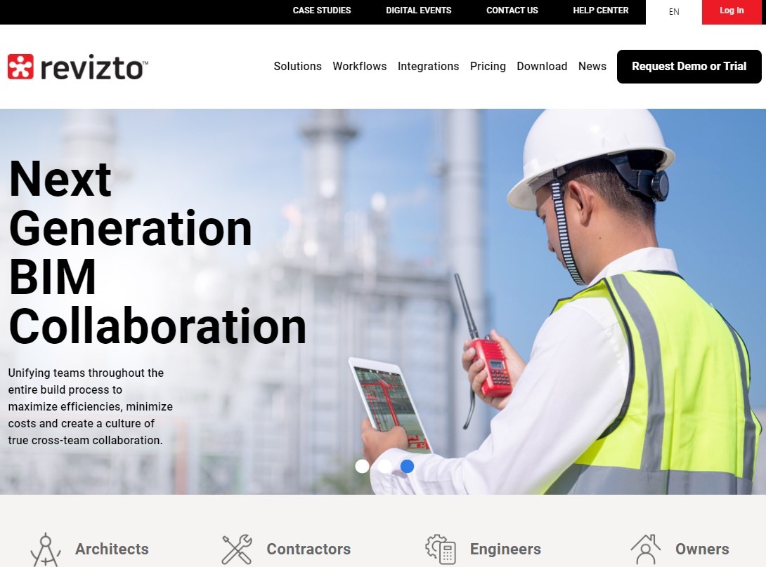
A collaboration platform such as Revizto unifies BIM data and serves as a central hub for model data, providing coordination tools and making data accessible for the entire project team. Revizto accommodates both 2D and 3D workflows, including a 2D/3D combined view that enables users to compare 2D sheets and work with live CDE documentation. By providing access to live data in a collaborative environment, the platform improves multi-actor communication, accountability, and transparency.
Accessible from either a desktop computer or mobile device, Revizto combines clash detection, grouping, a workflow builder, and issue tracker in a single environment. The clash detection feature includes a built-in automation tool to help teams perform clash testing on files, objects, and point clouds.
The issue tracker standardizes data flow and communication of model-based tasks among team members. By connecting and indexing relevant information in one place, users can access issues by title, type, status assignee, priority level and deadline.
The VR feature provides immersive, true-to-scale VR experiences to review model data. An integration with Resolve, a collaborative BIM coordination platform, brings issue tracking directly into Resolve’s multi-user platform available across the web and wireless VR headsets.
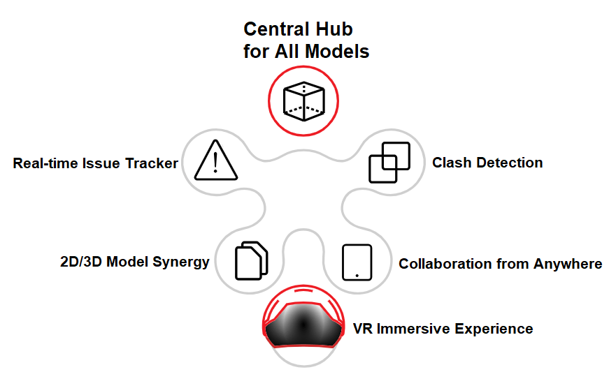
Revizto enables teams from multiple locations to collaborate and coordinate project workflows. Built on an open data format, Revizto can be leveraged with other industry formats such as industry foundation classes (IFC), BIM collaboration format (BCF), design web format (DWF), and others. These file formats are commonly encountered in BIM projects and enable interoperability and open exchange of information among team participants. The Revizto API allows industry partners to integrate specific platforms with Revizto project files, keeping project issues synchronized across various technologies.
Dashboards for Decision-Making in Big Projects
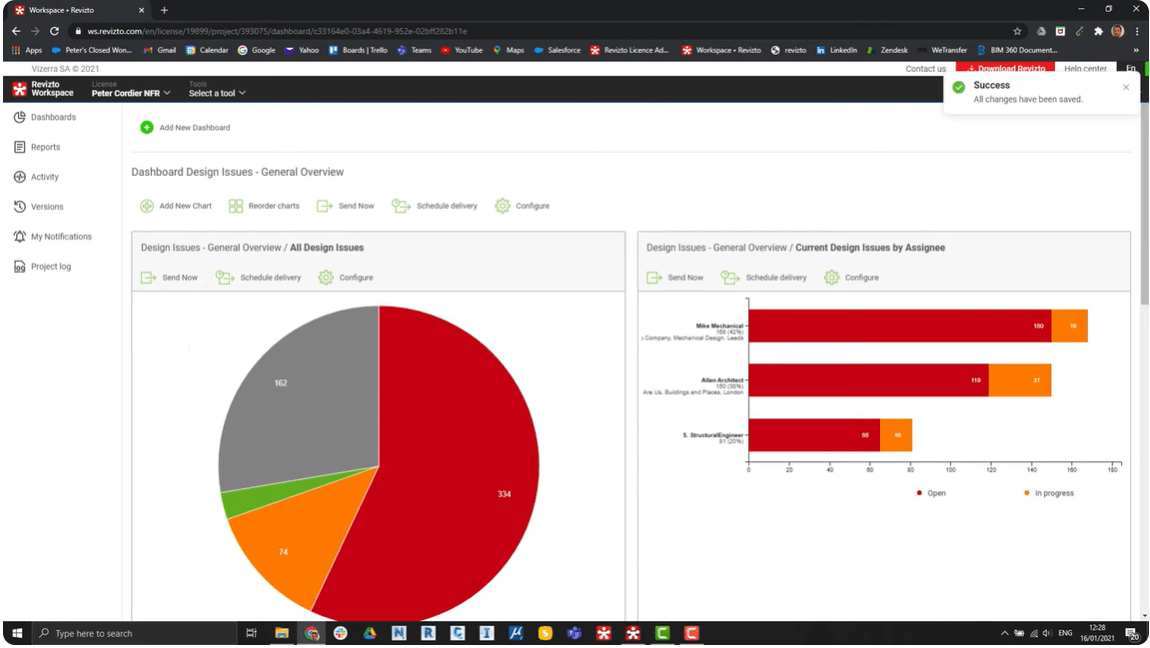
Dashboards provide an efficient way to gauge project performance at any time, by consolidating data from multiple sources and displaying charts, graphs, tables, and other reports. For example, a dashboard can display the status of design issues or construction issues and provide various metrics on those issues, such as how many issues are open or closed, and assignees to various issues.
By using dashboards, teams can get a current snapshot of various project indicators and make more informed decisions on budgeting, scheduling, risk management, allocation of project resources, and other considerations. Dashboards can also aid communication, as reports can be shared with team members and viewed concurrently in real time during meetings or in other discussions. In Revizto, users can create and share public dashboard links in the Revizto Workspace. Reports can also be scheduled for automated delivery, providing project participants with regular updates.
Essential Technology for Large-Scale Infrastructure Projects
As we’ve seen, a variety of tools are needed to handle the complexity of large infrastructure projects. Some tools have specific roles, while others provide multiple capabilities. For overview purposes, here is a summary of tools categorized as BIM, Integration and Coordination, AI and Automation, and GIS.
BIM
Revit
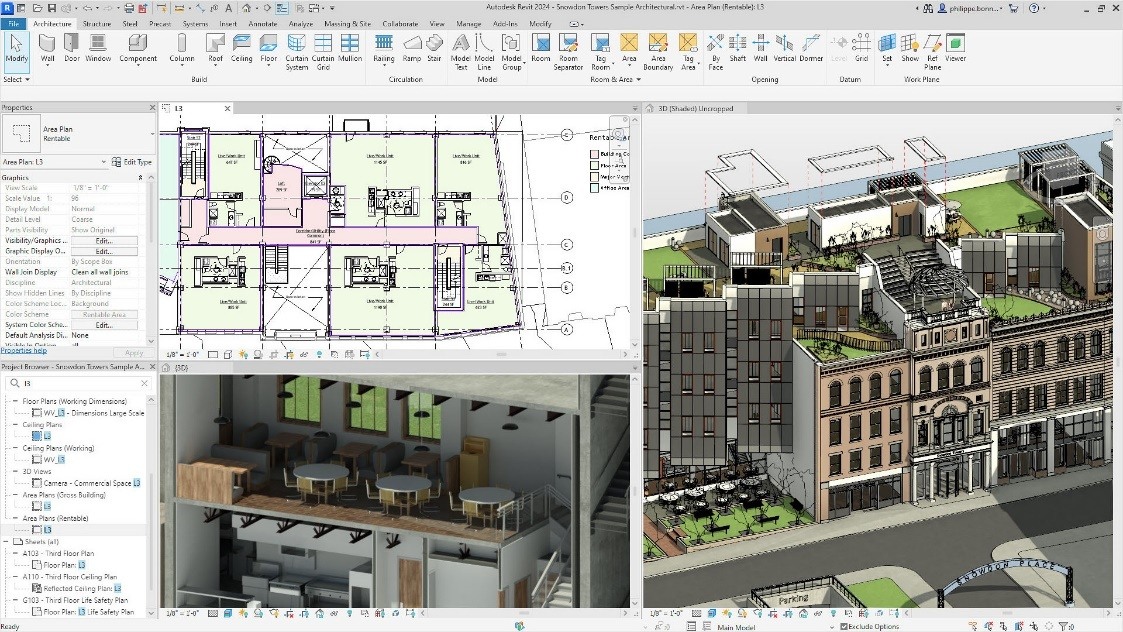
Revit, originally developed by Charles River Software and later acquired by Autodesk, is a popular BIM solution among architects, engineers, and contractors. It offers a wide range of design features, as well as quantity takeoff and other construction processes. Revit includes basic visualization capabilities and advanced parametric components that represent intelligent objects, such as doors and windows. Using a 4D model approach, Revit can track project lifecycles over time, with multiple team members working on the same project simultaneously. Construction teams can use phasing tools to visualize construction sequences. As an Autodesk product, it can be easily integrated with other Autodesk solutions, such as AutoCAD and Autodesk Construction Cloud products. For transportation and other infrastructure products, Autodesk offers Civil 3D and other specialty products.
Navisworks
Navisworks, also an Autodesk product, is a BIM solution geared more for project reviews than design. Like Revit, it is compatible with other Autodesk solutions as well as other project data formats. It includes a built-in visualization engine that supports renderings, walkthroughs, and animations. It also includes clash detection capabilities that can track clash resolution. Navisworks includes 4D BIM support by combining 3D BIM models with project scheduling data and 5D BIM with built-in quantity takeoff and cost estimating capabilities. Project managers can use Navisworks to review all project elements within the same environment while also validating construction sequences, analyzing design processes, and coordinating between different trades. Construction teams can track progress, validate project phasing, and coordinate site planning.
OpenBuildings Designer
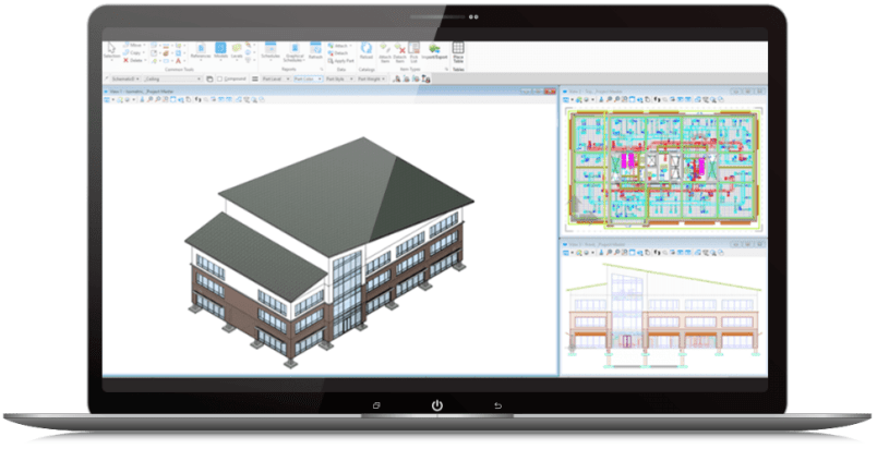
OpenBuildings Designer is built on Bentley’s MicroStation technology platform, providing a multi-discipline BIM solution for buildings and other facilities. It includes design, analysis, simulation, and documentation tools, incorporating computational design and building performance evaluation. It provides users with a 3D modeling environment and site context by referencing reality models. Coordination tools aid design integration across multiple disciplines and provide clash detection. As a Bentley product, OpenBuildings integrates readily with MicroStation design data and ProjectWise for collaboration and project management. OpenBuildings Designer is geared for building projects. For transportation and other infrastructure projects, Bentley offers other tools such as OpenFlows, OpenRoads, OpenRail, and OpenBridge.
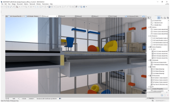
ArchiCAD
ArchiCAD is a BIM solution developed by Graphisoft primarily for design and visualization purposes. It includes built-in BIM-cloud technology for real-time collaboration and parametric modeling that maintains relationships between building elements. It also includes unique tools such as a MEP modeler that aids architectural-MEP coordination and a modular approach that enables development of reusable building modules. Architects and other designers use ArchiCAD for model creation, presentations, documentation, and other tasks, for both interior and exterior design. Construction teams can prepare detailed construction documentation, verify constructability, and perform quantity takeoffs.
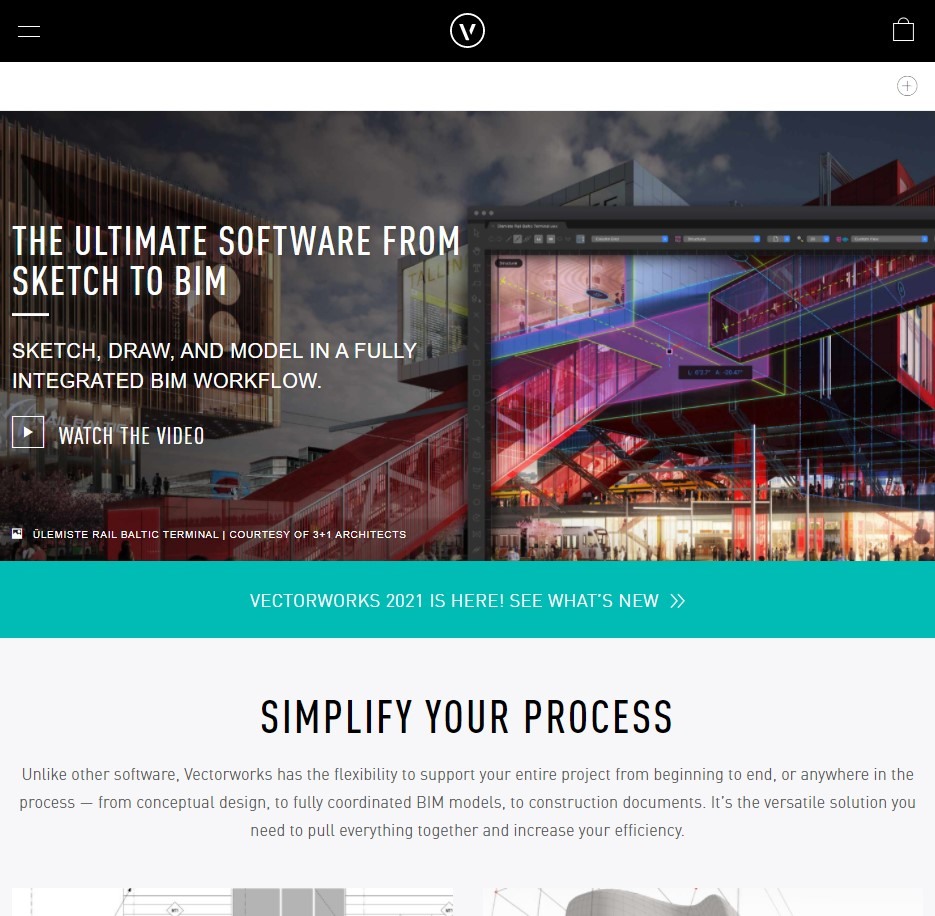
Vectorworks Architect
Vectorworks Architect uses smart objects – customizable, data-rich model elements that maintain relationships in the project environment – to provide 2D and 3D modeling
capabilities. It includes a built-in rendering engine and cloud service capabilities to offer web viewing, cloud storage, and project sharing. Architects, landscape architects, and interior designers can leverage an extensive library of objects, along with the ability to generate detailed construction documentation. Space planning capabilities enable designers to perform occupancy studies, energy analysis, and space programming through integrated worksheets and other tools.
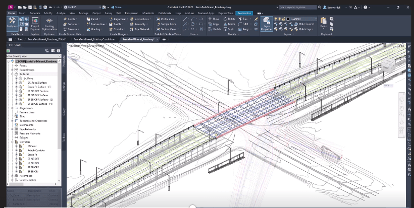
Autodesk Civil 3D
Civil 3D is an AutoCAD-based product focused on civil engineering, with some BIM features and workflows. It includes integrated capabilities for design, analysis, and documentation. Specific tools include comprehensive grading capabilities with automated earthwork volume assessment, roadway geometric design tools, pipe network and hydraulic analysis capabilities, surveying and land development, and dynamic modeling capabilities using intelligent objects that maintain relationships with one another. Engineers and designers can perform site and infrastructure design, roadway design, surface modeling, hydraulic design, and drawing production.
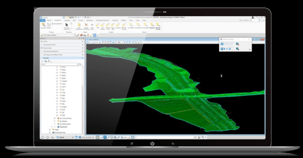
OpenRoads Designer and Other MicroStation-based Products
OpenRoads Designer is a Bentley MicroStation-based design application for surveying, drainage, subsurface utilities, and roadways. OpenRoads uses a model-centric approach that enables projects to incorporate multiple different data types, disciplines, and distributed teams. It includes roadway and highway design tools, along with survey, drainage, utilities, and other features. It enables creation of both traditional 2D deliverables and detailed 3D models with terrain, roadway, and site features. Bentley offers similar products for rail, bridge, and water resources.
Integration and Collaboration
Revizto
Revizto is an integrated BIM collaboration platform with the ability to merge 2D and 3D workflows into a single environment. It aids project communication with real-time issue tracking, model coordination, and clash detection. Revizto supports multiple data formats and creation of a unified model — a model everyone can work with. It includes visualization capabilities and enables users to create immersive real-time VR walkthroughs. As a hub for viewing all project information at any time, Revizto can work with schedules, specifications, detailed documentation, and other data types, and is adept at handling large data sets. More focused on coordination and communication than model creation, Revizto is designed to handle complex construction challenges and multifaceted projects, such as large-scale infrastructure projects, commercial developments, industrial plants, and healthcare facilities.
Autodesk Construction Cloud
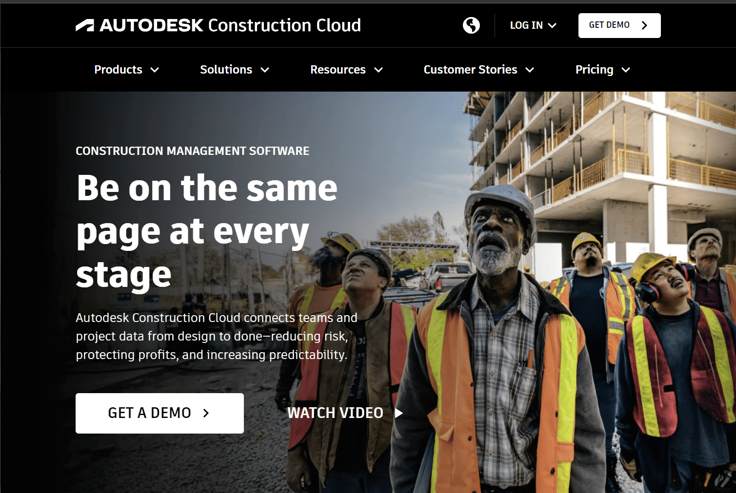
Previously known as Autodesk BIM 360, Autodesk Construction Cloud unifies planning, design, and construction workflows in one platform. As a cloud-based web service, it provides access to current project documents and enables users to manage quality control processes, track issues on-site, and coordinate with office and field personnel. It includes design review, BIM coordination, safety program checklists, issue management, coordination of deliverables, and
cost management capabilities. Model coordination capabilities enable creation of a single centralized project model using information from multiple sources. ACC is also adept at handling complex, multifaceted construction projects that require collaboration and coordination.
ProjectWise
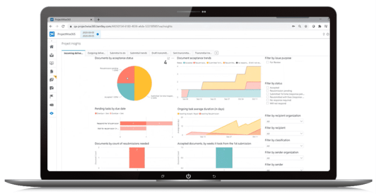
A Bentley product, ProjectWise works with multiple data types and infrastructure projects of any size. It is designed to provide digital project delivery with a comprehensive, standardized solution and includes data governance to provide consistency across multi-discipline teams and data security based on user identity. Data-driven portfolio intelligence helps users find applicable information and reuse design objects on multiple projects. Its engineering work-in-progress (WIP) focus aids collaboration with integrated co-authoring of documents, change log history, reference-file management, and maintenance of project standards.
Procore
Procore is a construction management platform that enables collaboration between project participants. It consists of four main parts: field productivity, construction financials, quality and safety, and project management. It provides custom workflow creation capabilities, financial management tools, and centralized document management with versioning and change tracking. While not a BIM authoring tool, it includes drawing management and markup features. Construction project managers can use Procore to coordinate projects, including team communication and schedule management. Field teams can complete daily logs and safety inspections with Procore’s mobile app while also performing various quality control actions and reporting on-site issues.
Primavera P6
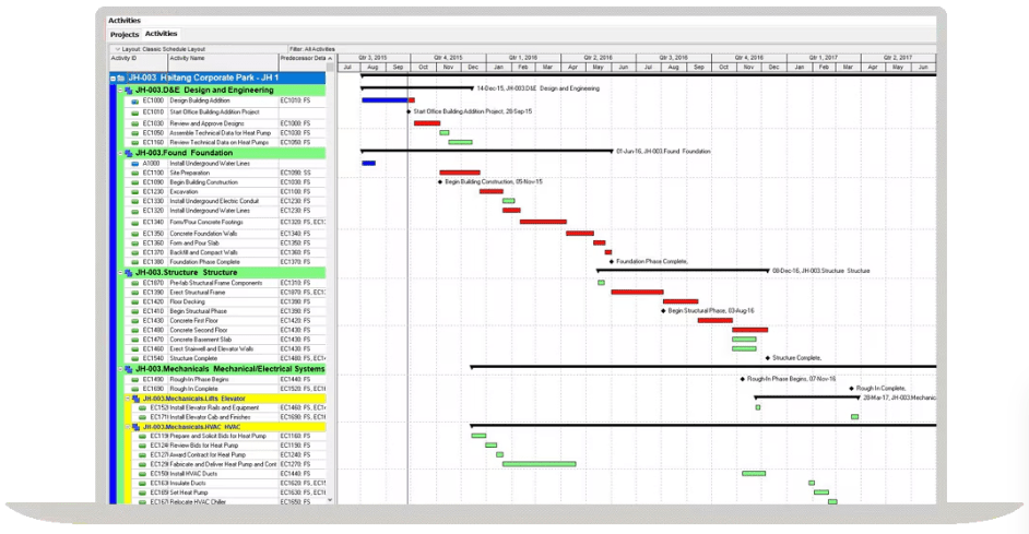
Oracle’s Primavera P6 is used for planning, managing, and evaluating projects, programs, and portfolios. As a cloud-based solution, it provides a web-based environment for managing projects of all sizes, ranging from a single user on a small project to thousands of users engaged in millions of activities across hundreds of projects. It includes role-based functionality to match team member needs and responsibilities, providing real-time views of project performance and numerous tools to analyze, record, and communicate information and make decisions. Users have alternate interfaces including interactive dashboards, web applications, and forms to consume and communicate project information.
Fieldwire
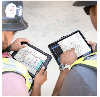
Fieldwire is a collaboration solution that provides centralized data storage and coordination capabilities alongside punch lists, as-built drawings, task management, custom forms, scheduling, and other tools. Fieldwire can be used as a desktop or mobile application. It includes versioning capabilities, reporting, and communication tools for project participants. Available in various levels, it includes tools for plan viewing, task management, and checklists, plus additional tools for sheet comparison, custom reports and forms, file storage, BIM viewing, RFI creation, and other capabilities, depending on the version.
AI and Automation
General Use AI Tools
Publicly available, general use AI tools offer an easy way for AEC professionals to wade into AI functionality. These tools include OpenAI’s ChatGPT, Google’s Gemini, and Microsoft and OpenAI’s GitHub Copilot. Users can type in prompts in a conversational style and receive output generated by the AI tool.
Construction-Focused Tools
A variety of construction-focused AI and automation tools have been introduced in recent years. A suite of tools from Slate Technologies uses AI to provide situational and contextually relevant insights in construction. The Slate platform combines AI, predictive analytics, and construction-specific intelligence to help teams optimize schedules, manage risk, and make decisions.
Other construction-focused AI tools include AirWorks for creating linework from geospatial data; ALICE, which uses AI to helps contractors and owners plan, bid and build projects; and nPlan, which uses machine learning to guide scheduling and other data-driven decisions.
Robotics and automation products are also useful on infrastructure projects. Dusty Robotics provides automated site layout with its FieldPrinter, which prints digital building models directly onto a job site surface Products from Trimble and Boston Dynamics use laser scanners on robots to enable collection of large amounts of location data on construction sites. Many other automation tools are available for AEC professionals.
Integrated AI Tools
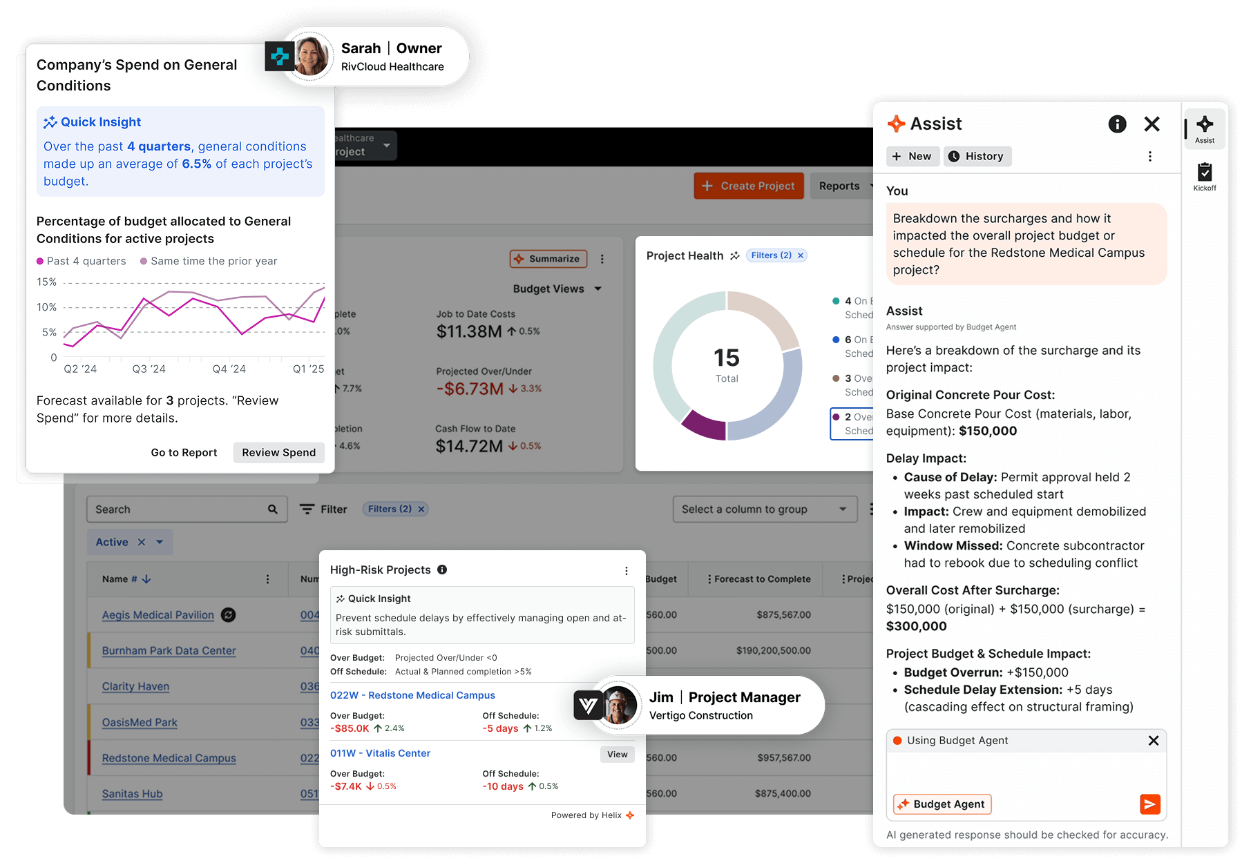
AI-powered tools are increasingly becoming integrated in commercial software. Autodesk has included some basic AI functionality in its products, such as the Markup Assist feature in AutoCAD and tools in Autodesk Construction Cloud for scanning specification documents to generate submittal logs. Bentley has incorporated AI into several products and introduced a separate product, OpenSite+, that uses AI to aid design of residential, commercial, and industrial sites. Procore introduced Helix as an AI-driven tool for automating routine tasks, developing critical insights, and guiding decision-making. Other AEC vendors have also introduced AI tools in their software.
GIS
GIS has historically been a specialty outside the realm of AEC professionals, but lines are blurring between GIS and AEC work. Esri, which developed the widely used ArcGIS platform, partnered with Autodesk to integrate GIS and BIM technology. Esri’s ArcGIS GeoBIM connects with Autodesk Construction Cloud products, enabling teams to integrate and visualize project data in a single platform. Autodesk introduced the Autodesk Connector for ArcGIS, which enables users of Autodesk Civil 3D, InfraWorks, and Map 3D to bring GIS content directly into a design model.
Summary of Highlighted Products
| Product | Primary Purpose | Description |
| Revit | BIM | Comprehensive BIM software. |
| Navisworks | BIM | BIM solution focused on review capabilities. |
| OpenBuildings Designer | BIM | BIM solution tailored for buildings; based on MicroStation. |
| Vectorworks Architect | BIM | Multifunctional BIM solution. |
| ArchiCAD | BIM | BIM solution geared for architectural design and visualization. |
| Civil 3D | Civil/Transportation BIM | BIM solution specifically for civil engineering; based on AutoCAD. |
| OpenRoads | Civil/Transportation BIM | BIM solution specifically for civil engineering; based on MicroStation. |
| Revizto | Integration and Collaboration | Collaboration platform with a strong focus on clash detection and issue tracking. |
| Autodesk Construction Cloud | Integration and Collaboration | Comprehensive cloud-based platform for coordination and data management. |
| ProjectWise | Integration and Collaboration | File and data management solution geared for digital project delivery. |
| Procore | Integration and Collaboration | Construction management platform that enables collaboration between project participants. |
| Primavera P6 | Integration and Collaboration | Project management solution for planning, managing, and evaluating projects, programs, and portfolios. |
| Fieldwire | Integration and Collaboration | Collaboration solution that provides centralized data storage and coordination capabilities. |
Key Takeaways
- Construction of large infrastructure projects is highly challenging and requires digital tools to help manage many complexities.
- Tools such as building information modeling (BIM), automation, virtual reality (VR), and artificial intelligence (AI) can help teams handle data from multiple sources and address numerous technical and logistical challenges.
- Teams working on large-scale building projects should consider an established BIM product such as Revit or OpenBuildings Designer as their primary BIM tool. Teams working on large-scale transportation projects should consider Autodesk Civil 3D or Bentley OpenRoads designer. Other projects may also use any of these or other products.
- Along with a primary BIM tool, teams should have a common data environment (CDE) such as Autodesk Construction Cloud or ProjectWise and an integrated collaboration platform such as Revizto to successfully deliver large infrastructure projects. Team communication software for construction is essential.
- Project management software such as Procore or Primavera P6 can help teams coordinate large-scale projects, particularly in the construction phase.
- Other speciality tools for areas such as AI, VR, GIS, and automation should be implemented as needed on a project-specific basis.
Conclusion
With the complex nature of construction, AEC professionals need the right digital tools for infrastructure projects. Tools such as building information modeling (BIM), automation, virtual reality (VR), and artificial intelligence (AI) can help teams handle data from multiple sources and address numerous technical and logistical challenges. Along with the various tools used for planning, design, construction, and O&M, a common data environment (CDE) and an integrated collaboration platform are also critical to the success of large infrastructure projects.
FAQ
What are the most effective digital tools for managing complexity in large-scale infrastructure projects?
AEC teams typically need a combination of construction technology, including BIM, integration, collaboration, and specialty tools, to handle design and construction workflows. Specific products are listed in this article.
How can digital solutions address complexity in construction scheduling?
With digital construction solutions, teams can collaborate and better coordinate scheduling of project workflows. Scheduling software working in conjunction with BIM in a common data environment (CDE) aids planning, scheduling, and other activities in complex projects.
In what ways does BIM improve coordination across construction timelines?
BIM helps teams collaborate and improve productivity and coordinate scheduling of project workflows. Interdisciplinary design teams can collaborate on design, perform design reviews, and track issues from a centralized platform. Different design disciplines and construction processes can be coordinated using BIM to identify issues before they occur in the field.
How do AI-driven planning tools enhance schedule accuracy and reduce delays?
AI can help identify potential schedule, budget, labor, and material issues based on similar projects and other pertinent data.
How can GIS-based visualization tools help manage spatial complexity in infrastructure projects?
BIS-based visualization allows BIM data to be viewed in context with their surroundings and infrastructure. Integration of GIS and BIM data enables reuse of valuable data and reduces data redundancy. Organizations can make more accurate and data-driven decisions about the environmental impact and sustainability of infrastructure projects.
Unlock seamless BIM collaboration — request your demo today


