Your data. Your tools. Your way.
The Revizto API gives your team and your systems direct, programmatic access to rich project data in real time. Stop waiting for manual exports. Connect, automate, and build on the data you already have.

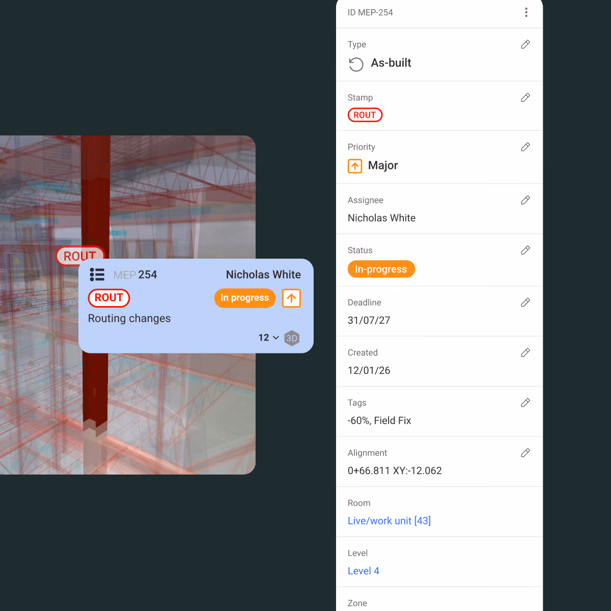
Every issue. Full context.
Pull issue and clash data with full history, status, assignments, and 3D spatial location. Create issues directly from geotagged photos, bulk-import from CSV, or sync with external platforms automatically.
- Issue status, priority, and resolution history
- Clash data with groupings intact
- XYZ spatial coordinates on every issue
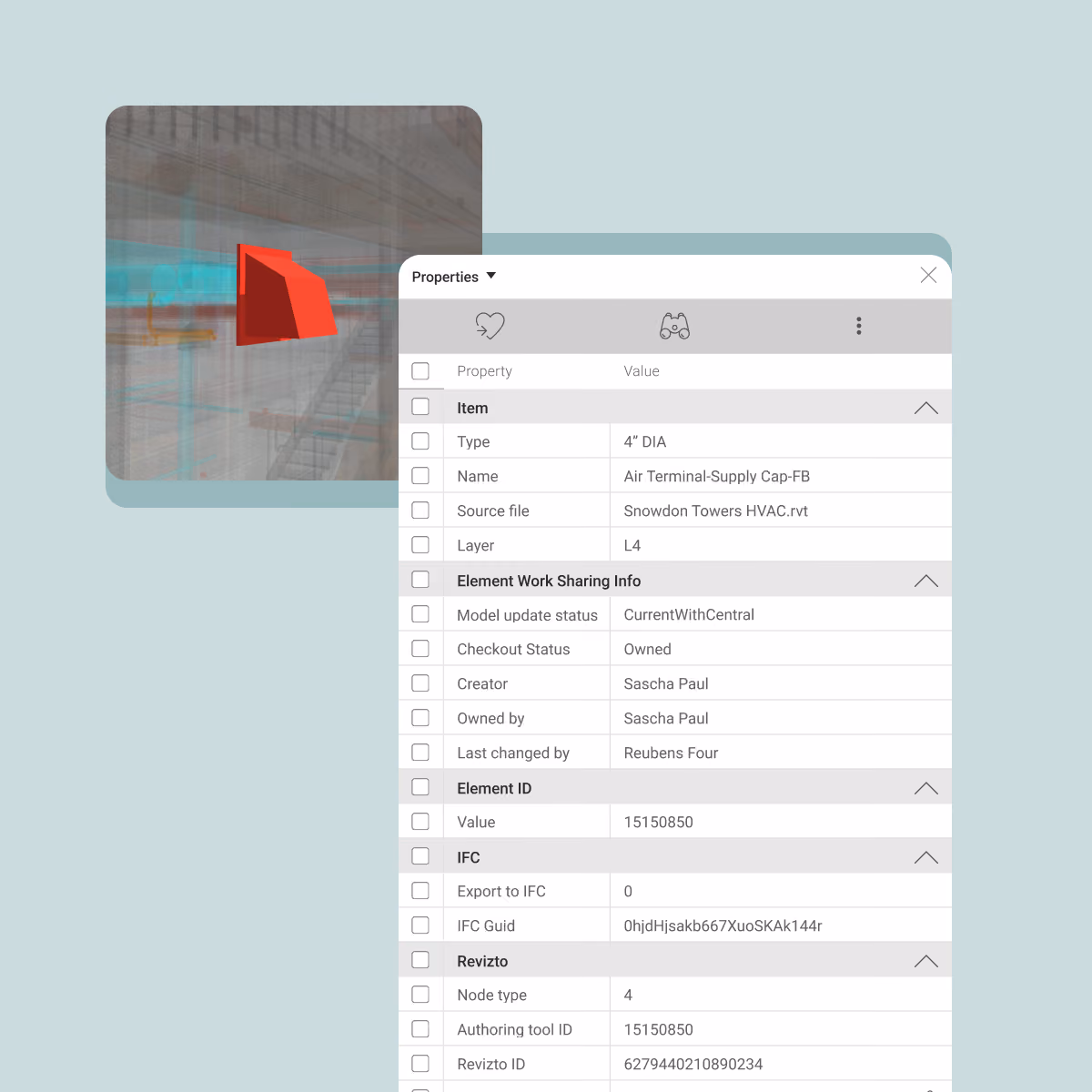
Query your model. From any application.
Access object-level metadata directly – fire ratings, material specs, system types, quantities – without opening the Revizto application. Feed model data into cost estimation tools, progress dashboards, or facility management systems.
- Automated quantity takeoffs and cost estimations
- Live dashboards for installation progress and carbon impact
- Simple integration with procurement and FM systems
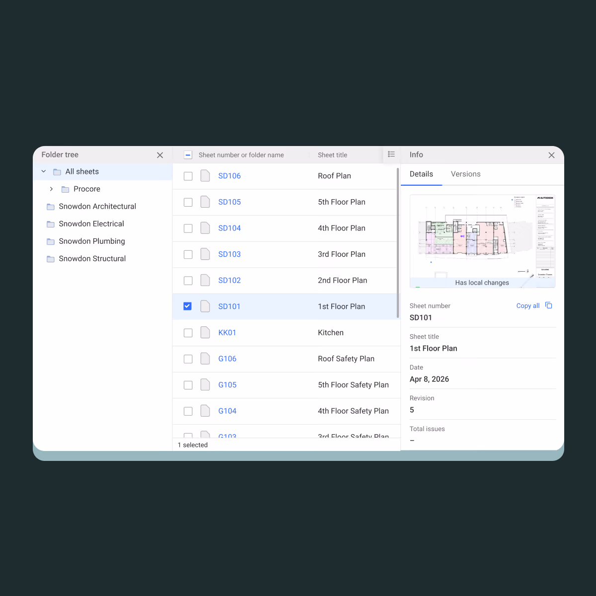
Sheet and model metadata at your fingertips
Query 2D drawing and 3D model metadata natively. Keep downstream tools in sync with what is actually published in the project. No manual version tracking required.
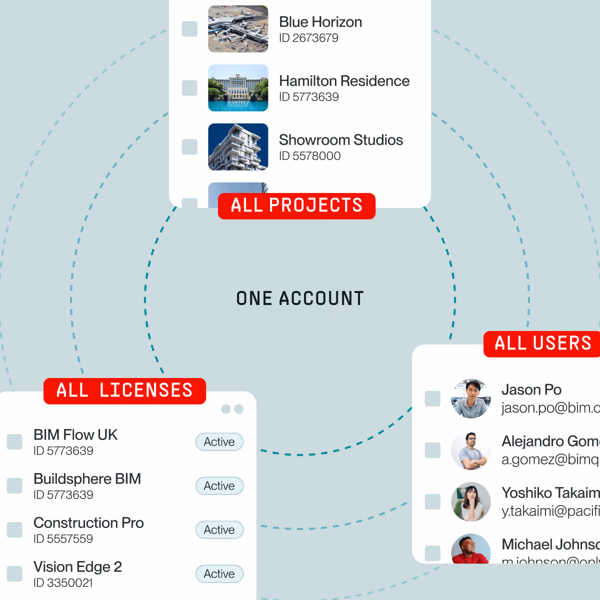
Access control. Always current.
Manage users, roles, and project access automatically. Sync your Revizto team lists with external identity and user management systems so your access controls never fall out of step.
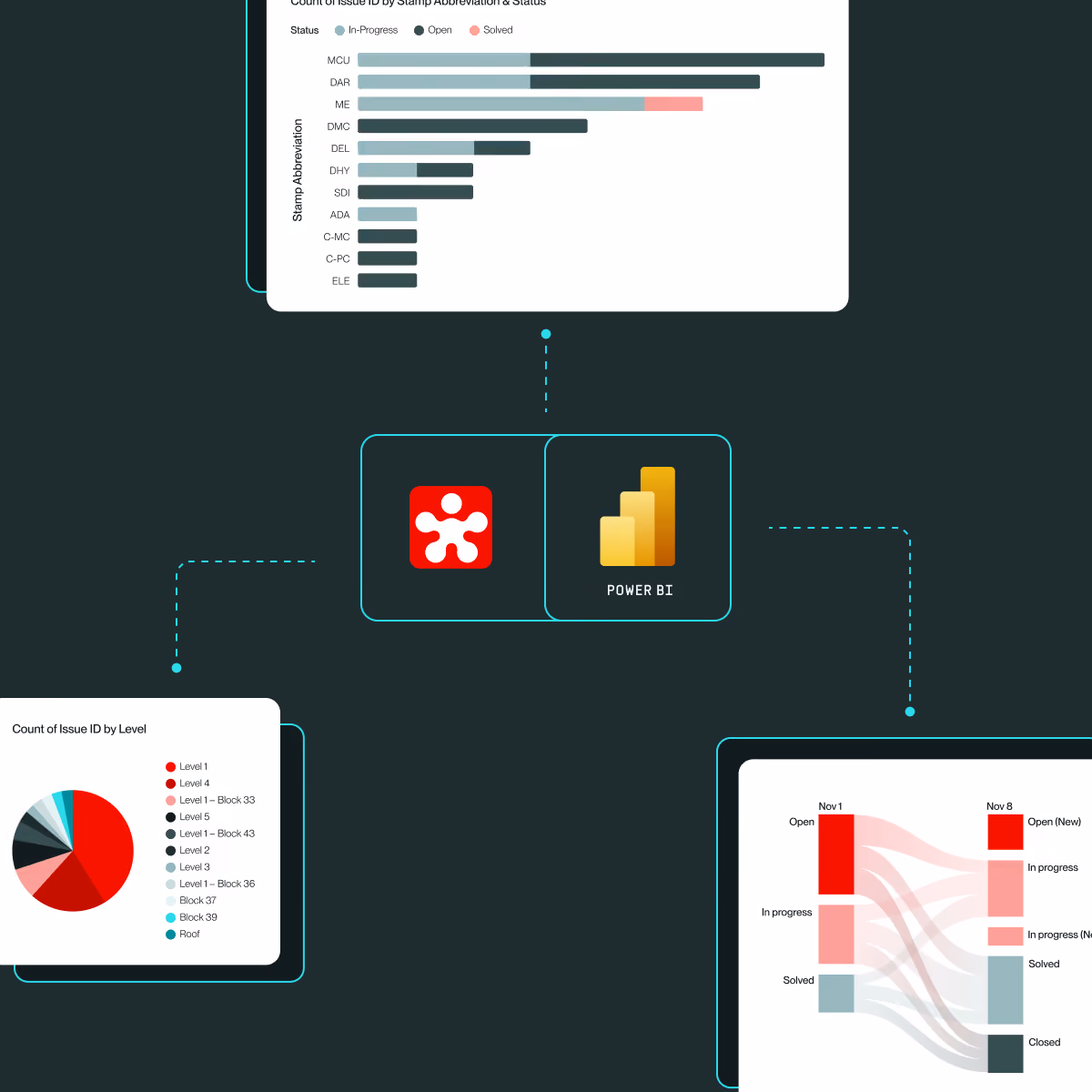
Instant Power BI dashboards. Out of the box.
A dedicated connector gives you direct access to your issues, clashes, and team data inside Microsoft Power BI. Ready-made dashboard templates get you up and running fast.
- Pre-built templates
- No API calls or custom code to get started
- Custom queries for deeper analysis
Delivering value. Fast and securely.


Trusted by teams building the world's most complex projects


“Revizto continues to deliver high-quality, well-documented API access, and the introduction of Model and Object-level endpoints represents a major milestone. It now enables us to perform the full suite of high-value operations we need in a consistent, automated way. Having access to these endpoints has been the missing piece for us. It enables true end-to-end data compliance and quality auditing as an automated, scalable process. This is something that was previously very difficult to achieve.”


“The new Revizto API endpoints significantly expand the possibilities for data analysis and process automation. In addition to accessing alphanumeric component data, we can now retrieve and evaluate valuable model-related metadata such as synchronization timestamps and model author information.”


“For too long, model data has been out of reach for the people controlling delivery — from progress monitoring through cost control to handover. Revizto opening that data up, and Morta letting them work with it directly in the processes they already run, means the model stops being a static deliverable and starts being something they use day-to-day.”

Start building today
Full documentation is live at developer.revizto.com.
The free API Essentials course on Revizto Academy covers everything you need to get going.
Want AI to work with your data too?
The MCP Server connects your own AI directly to Revizto. No code, no vendor lock-in.